| Historical Source |
| H |
|
Hull House Map (Nationalities), 1895
|
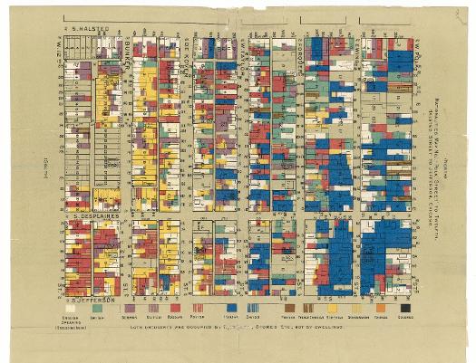
One of the many projects of the Hull House Settlement was to conduct careful studies of its Near West Side neighborhood, which housed many of Chicago's most recent immigrants, most of whom came from central, southern, and eastern Europe. This map, which appeared in the volume
Hull-House Maps and Papers, depicts nationalities of residents in the area bordered by Polk, Twelfth (now Roosevelt Road), Halsted, and Jefferson Streets.
The Electronic Encyclopedia of Chicago © 2005 Chicago Historical Society.
The Encyclopedia of Chicago © 2004 The Newberry Library. All Rights Reserved. Portions are copyrighted by other institutions and individuals. Additional information on copyright and permissions.
The Encyclopedia of Chicago © 2004 The Newberry Library. All Rights Reserved. Portions are copyrighted by other institutions and individuals. Additional information on copyright and permissions.