| Historical Source |
| R |
|
Regional Waterways Map, 2004
|
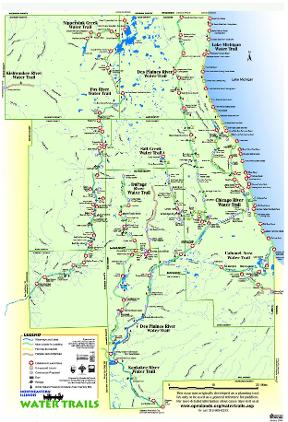
This 2004 map compiled by the Openlands Project shows waterways in the Chicago region, focusing on the region from the perspective of the recreational boater and highlighting water trails for small, non-motorized boats. A closer look at this map reminds us of the many changes which have taken place since the nineteenth and twentieth centuries, when wharves, factories, warehouses, and railroads fronted the rivers of the region. Until the 1920s, untreated sewage from industries and residences poured into these waterways, making most open sewers. Waterways and their banks were places to be avoided until the late twentieth century, when deindustrialization, heightened environmental concern, and changing transportation left waterways cleaner and emptier. Groups like Openlands have encouraged new and innovative ways of thinking about regional waterways.
The Electronic Encyclopedia of Chicago © 2005 Chicago Historical Society.
The Encyclopedia of Chicago © 2004 The Newberry Library. All Rights Reserved. Portions are copyrighted by other institutions and individuals. Additional information on copyright and permissions.
The Encyclopedia of Chicago © 2004 The Newberry Library. All Rights Reserved. Portions are copyrighted by other institutions and individuals. Additional information on copyright and permissions.