| The Plan of Chicago |
| Chicago in 1909 |
| Planning Before the Plan |
| Antecedents and Inspirations |
| The City the Planners Saw |
| The Plan of Chicago |
| The Plan Comes Together |
| Creating the Plan |
| Reading the Plan |
| A Living Document |
| Promotion |
| Implementation |
| Heritage |

|
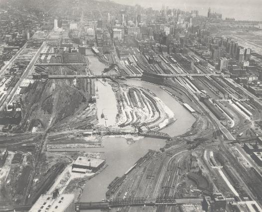
This photograph was taken in 1929, a year before the river-straightening project was completed. The view is from the south toward downtown, and at this point is it possible to see both the river's old path and its new one. The photograph also makes evident how much of the real estate in this area was devoted to railroad tracks and yards. |
||
|
The Electronic Encyclopedia of Chicago © 2005 Chicago Historical Society.
The Encyclopedia of Chicago © 2004 The Newberry Library. All Rights Reserved. Portions are copyrighted by other institutions and individuals. Additional information on copyright and permissions. |
||