| The Plan of Chicago |
| Chicago in 1909 |
| Planning Before the Plan |
| Antecedents and Inspirations |
| The City the Planners Saw |
| The Plan of Chicago |
| The Plan Comes Together |
| Creating the Plan |
| Reading the Plan |
| A Living Document |
| Promotion |
| Implementation |
| Heritage |

Plan of Chicago, Plate CXXXII

Guerin's dark pastel drawing of the Civic Center at Congress and Halsted illustrates the planners' wish to make Congress Parkway the city's grand east-west axis, a major boulevard extending from Grant Park to the Civic Center and well beyond.
Construction of Congress Parkway
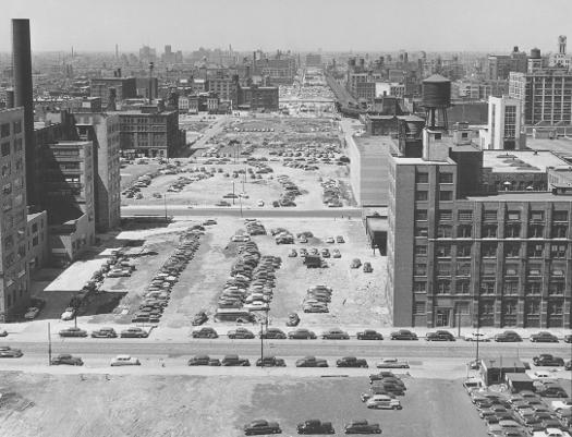
The view here is west from the former main Post Office, under which Congress Parkway still passes. Construction on the Congress (later the Eisenhower) Expressway, into which the parkway leads, began in 1949.
Congress Parkway, Looking West from Grant Park, 2004
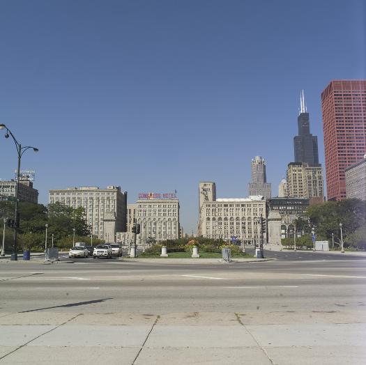
The vantage here is from west of the Buckingham Fountain, which is located where Congress Street terminates at the lakefront. Congress Parkway is a wide and handsome divided boulevard within the park. It narrows west of Michigan Avenue, where it passes between the Congress Hotel and the Auditorium, before widening again as it leads into the Eisenhower Expressway.
The Encyclopedia of Chicago © 2004 The Newberry Library. All Rights Reserved. Portions are copyrighted by other institutions and individuals. Additional information on copyright and permissions.