| The Plan of Chicago |
| Chicago in 1909 |
| Planning Before the Plan |
| Antecedents and Inspirations |
| The City the Planners Saw |
| The Plan of Chicago |
| The Plan Comes Together |
| Creating the Plan |
| Reading the Plan |
| A Living Document |
| Promotion |
| Implementation |
| Heritage |

The River before Straightening
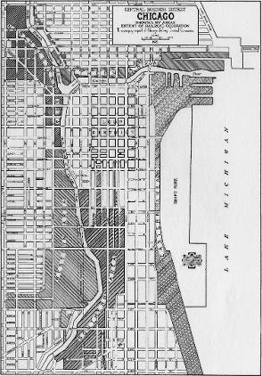
This 1921 map clearly shows the eastward bend in the Chicago River south of the Loop. The bend cuts off several north-south streets and creates irregularly shaped pieces of real estate in the city's rigid grid pattern. The proposed channel that would straighten the river is marked with dotted lines.
Chicago River Straightening, 1929
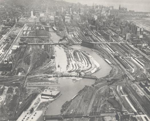
This remarkable photograph of the Chicago River looking north shows both the old river course, soon to be filled in, and the new manmade one. The commercial downtown is in the background. Most of the real estate on both sides of the river in this area is dominated by railroad infrastructure.
View North along the Chicago River, 2004
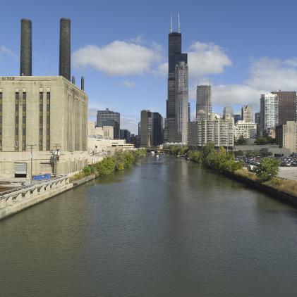
This photograph was taken from the bridge at Roosevelt Road. The view is north along river toward the Sears Tower and the western edge of downtown.
The Encyclopedia of Chicago © 2004 The Newberry Library. All Rights Reserved. Portions are copyrighted by other institutions and individuals. Additional information on copyright and permissions.