| The Plan of Chicago |
| Chicago in 1909 |
| Planning Before the Plan |
| Antecedents and Inspirations |
| The City the Planners Saw |
| The Plan of Chicago |
| The Plan Comes Together |
| Creating the Plan |
| Reading the Plan |
| A Living Document |
| Promotion |
| Implementation |
| Heritage |

Plan of Chicago, Plate CVII

The Plan proposed improving the appearance and the functionality of the riverfront in the heart of the city by building multi-level roads along its banks. This improvement was suggested by the example of Paris, among other cities.
South Water Street market, West from Dearborn
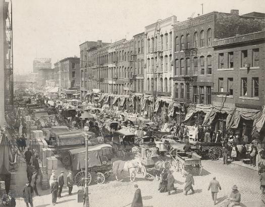
One of the planners' main goals for the riverfront was to move the congested South Water Street wholesale market, which was located just south of the Main Branch of the Chicago River, away from the downtown.
Wacker Drive, 2004
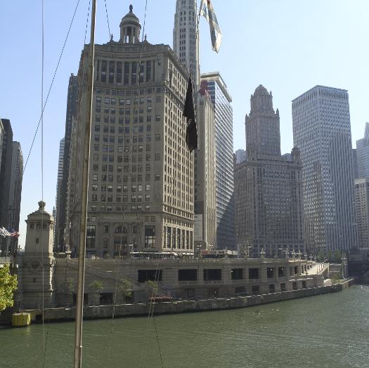
The view is southwest from the Michigan Avenue Bridge. The construction of Wacker Drive in the 1920s removed the South Water Street market area and created a handsome upper-level riverfront boulevard, a lower-level roadway for commercial and through traffic, and a recreational walkway along the river.
The Encyclopedia of Chicago © 2004 The Newberry Library. All Rights Reserved. Portions are copyrighted by other institutions and individuals. Additional information on copyright and permissions.