| The Plan of Chicago |
| Chicago in 1909 |
| Planning Before the Plan |
| Antecedents and Inspirations |
| The City the Planners Saw |
| The Plan of Chicago |
| The Plan Comes Together |
| Creating the Plan |
| Reading the Plan |
| A Living Document |
| Promotion |
| Implementation |
| Heritage |
Michigan Avenue Bridge

Michigan Boulevard

This Guerin drawing of a much widened and improved Michigan Avenue looking north does not emphasize the proposed Michigan Avenue Bridge as much as it does what such a bridge would make possible: the conversion of the street into a continuous boulevard connecting the South and North Sides.
Aerial View of the Michigan Avenue Bridge
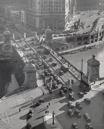
The view in this photograph, which was taken in 1935, is southwest from the fifteenth floor of the Tribune Building. Wacker Drive is visible in the upper right.
Michigan Avenue Bridge, 2004
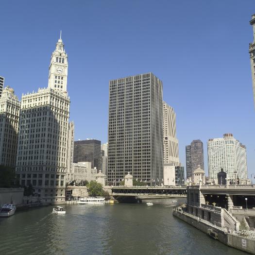
This photograph was taken from the west side of the bridge. The bridge's lower level for commercial traffic, an important Plan proposal, is visible from this angle.
The Electronic Encyclopedia of Chicago © 2005 Chicago Historical Society.
The Encyclopedia of Chicago © 2004 The Newberry Library. All Rights Reserved. Portions are copyrighted by other institutions and individuals. Additional information on copyright and permissions.
The Encyclopedia of Chicago © 2004 The Newberry Library. All Rights Reserved. Portions are copyrighted by other institutions and individuals. Additional information on copyright and permissions.