| The Plan of Chicago |
| Chicago in 1909 |
| Planning Before the Plan |
| Antecedents and Inspirations |
| The City the Planners Saw |
| The Plan of Chicago |
| The Plan Comes Together |
| Creating the Plan |
| Reading the Plan |
| A Living Document |
| Promotion |
| Implementation |
| Heritage |
Link Bridge

Plan of Chicago, Plate CXXXVII

Guerin's bird's-eye view of the lakefront from the west. The Link Bridge crosses the Main Branch of the Chicago River in the center left of the drawing, just before the river meets a proposed lagoon in Lake Michigan created by new harbor and recreational facilities.
Dedication of the Bridge
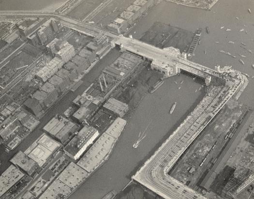
This aerial view of what is also known as the Outer Drive Bridge was taken in 1937, when President Franklin Roosevelt appeared at the dedication. The sharp angles in the Outer Drive were considerably eased with the completion of the current S-curve in 1986.
Link Bridge, 2004
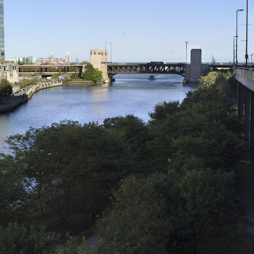
The view east along the river of the double-decker bridge. The lower level includes a bicycle and pedestrian path.
The Electronic Encyclopedia of Chicago © 2005 Chicago Historical Society.
The Encyclopedia of Chicago © 2004 The Newberry Library. All Rights Reserved. Portions are copyrighted by other institutions and individuals. Additional information on copyright and permissions.
The Encyclopedia of Chicago © 2004 The Newberry Library. All Rights Reserved. Portions are copyrighted by other institutions and individuals. Additional information on copyright and permissions.