| The Plan of Chicago |
| Chicago in 1909 |
| Planning Before the Plan |
| Antecedents and Inspirations |
| The City the Planners Saw |
| The Plan of Chicago |
| The Plan Comes Together |
| Creating the Plan |
| Reading the Plan |
| A Living Document |
| Promotion |
| Implementation |
| Heritage |

Plan of Chicago, Plate LXXXVII

Guerin's sunset view of the lakefront from the west clearly shows the Plan's proposal that two municipal piers should be constructed, one at 22nd Street, the other at Chicago Avenue.
Navy Pier, ca. 1920-21
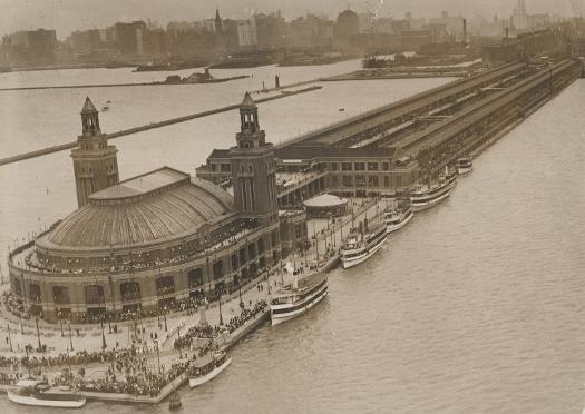
This view is from the northeast. Only the northern of the two proposed piers was built, and it was located at Grand Avenue instead of Chicago Avenue. This pier opened in 1916 and was named Navy Pier in the 1920s. The great ballroom at its eastern end was restored in 1976, but the shipping facilities behind it, which were devoted to a multitude of uses over the years and had badly deteriorated, were replaced by the current recreational and entertainment complex in 1994.
Navy Pier, 2004
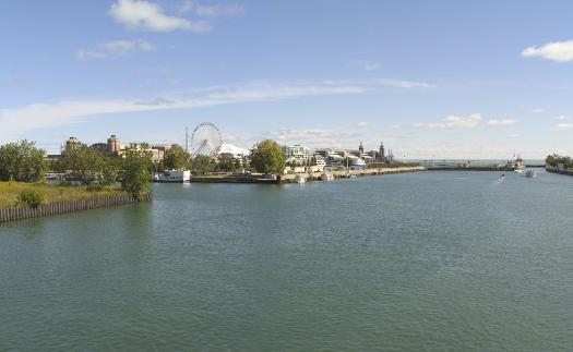
The view is looking northeast from the pedestrian walkway on the lower level of the Link Bridge. The ballroom at the eastern end of the pier is visible, as is the 1990's Ferris wheel, an homage to the first Ferris wheel, which was a major attraction on the Midway at the World's Columbian Exposition of 1893.
The Encyclopedia of Chicago © 2004 The Newberry Library. All Rights Reserved. Portions are copyrighted by other institutions and individuals. Additional information on copyright and permissions.