|
The Plan of Chicago
|
| Chicago in 1909 |
| Planning Before the Plan |
| Antecedents and Inspirations |
| The City the Planners Saw |
| The Plan of Chicago |
| The Plan Comes Together |
| Creating the Plan |
| Reading the Plan |
| A Living Document |
| Promotion |
| Implementation |
| Heritage |

One of Hull House's many projects was to conduct careful studies of its Near West Side neighborhood, which housed many of Chicago's most recent immigrants, most of whom came from central, southern, and eastern Europe. These maps appeared in the volume Hull-House Maps and Papers , which was published in 1895.
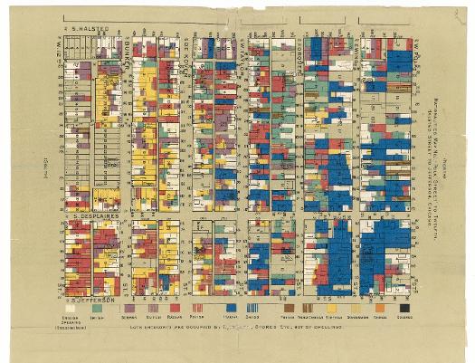
Nationalities in the area bordered by Polk, Twelfth (now Roosevelt Road), Halsted, and Jefferson Streets.
See also: Chicago School of Sociology; Hull House; Settlement Houses
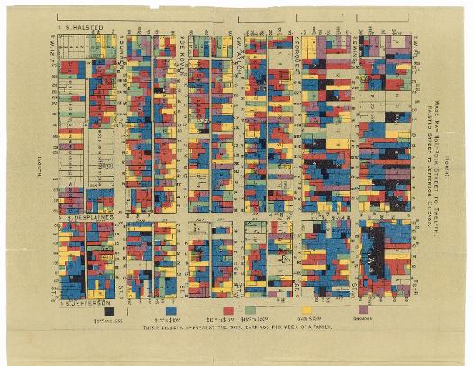
This wage map for the same area shows that the weekly wages for most families in the neighborhood was between five and fifteen dollars for a six-day week.
See also: Chicago School of Sociology; Hull House
The Encyclopedia of Chicago © 2004 The Newberry Library. All Rights Reserved. Portions are copyrighted by other institutions and individuals. Additional information on copyright and permissions.