| The Plan of Chicago |
| Chicago in 1909 |
| Planning Before the Plan |
| Antecedents and Inspirations |
| The City the Planners Saw |
| The Plan of Chicago |
| The Plan Comes Together |
| Creating the Plan |
| Reading the Plan |
| A Living Document |
| Promotion |
| Implementation |
| Heritage |
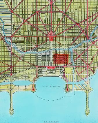
A comprehensive diagram, colored (the Loop is highlighted in red) for greater visual effect, of the Plan ’s masterful and aesthetically compelling solution to the problem of congestion and proposal for the lakefront.
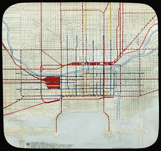
A more technical diagram of how Chicago’s wide variety of local and long distance rail lines might better serve the city, especially if new consolidated passenger terminals (seen in red) are built west (toward the top of the diagram) and south (toward the left of the diagram) of downtown. A key to the diagram is on the left side of the bottom of the slide. It can be more easily read by using the zoom tool.
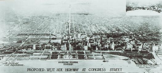
A depiction of how Congress Street might become what the planners called the east-west “Axis of Chicago,” a boulevard extending from Grant Park to the Civic Center and on to the western border of the city. It is possible to date this image with relative precision since Buckingham Fountain (1927) is visible, but the Shedd Aquarium (1929) has not yet been erected.
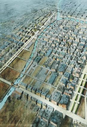
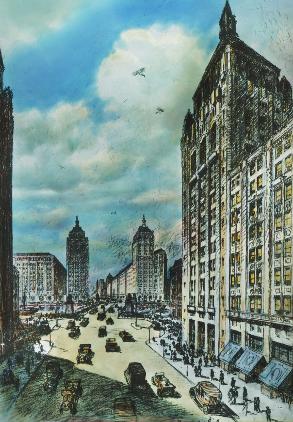
A bird’s-eye view, looking northwest, of the downtown, before the South Branch of the Chicago River was straightened at the end of the 1920s. The depiction of the buildings in the center of the city is far more accurate than those in Guerin's drawings in the Plan.
This slide shows how a widened Michigan Avenue, with the construction of a new bridge, can be transformed into a continuous boulevard that will open up the North Side to downtown and develop commercial real estate both north and south of the river.
The Encyclopedia of Chicago © 2004 The Newberry Library. All Rights Reserved. Portions are copyrighted by other institutions and individuals. Additional information on copyright and permissions.