|
Gallery
|
| The Grid |
| Origins of the Grid |
| The River Breaks the Grid |
| Rationalization of Streets |
| Embracing / Rejecting the Grid |
| Transportation and the Grid |
Itemized sales between Beaubien & Boyer and N. R. Norton, 1837
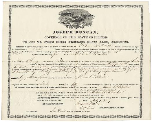
The deed issued to Madore Beaubien, son of fur trader Jean Baptiste Beaubien and Mahnobunoqua, a Grand River Ottawa woman, gave him title to "Lot number eight (8) of Block number one hundred and nineteen (119) of Section Sixteen Township Thirty five in North Range [Ten] East of the third principal meridian" in "Juliett." At the time this deed was issued, in 1830, Cook County extended further south than it does now to include Joliet, then known as Juliet or Juliett.
See also: Cook County; Fur Trade; Joliet, IL; Metis; County Boundaries (Map)
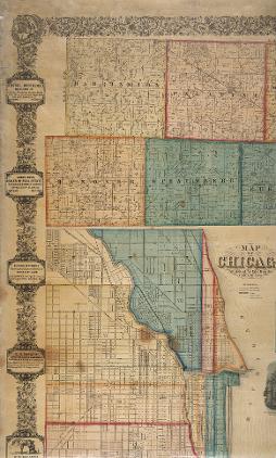
This large, detailed map identifies title-holders of developed and undeveloped areas of Cook County outside Chicago in 1861. Sections that had been laid down by government surveyors and sold as single parcels subsequently had been divided into smaller lots for purchase. The boundaries of many of these smaller, subdivided holdings followed the familiar rectangular grid pattern, rather than rivers or other natural boundaries.
See also: Cook County; Initial Land Sales in NE Illinois (Map); Planning Chicago; Real Estate; Land Use
Letter from Dixwell Lathrop to John Rockwell, 11 June 1835
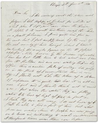
In Chicago, as in much of the Northwest Territory, the division of the land into lots for sale led to feverish land speculation. In 1835, John Rockwell commissioned Dixwell Lathrop to purchase land in the city as an investment. In this letter to Rockwell, Lathrop discusses the auctions of lots in Chicago. He is unimpressed by the town, and the price of $155 per square foot for water lots strikes him as "crazy." He announces that he will probably "bring your money home with me."
See also: Northwest Ordinance; Waterfront; Encountering the Prairie
|
The Electronic Encyclopedia of Chicago © 2005 Chicago Historical Society.
The Encyclopedia of Chicago © 2004 The Newberry Library. All Rights Reserved. Portions are copyrighted by other institutions and individuals. Additional information on copyright and permissions. |