The Plan of Chicago
Northerly Island, 1933
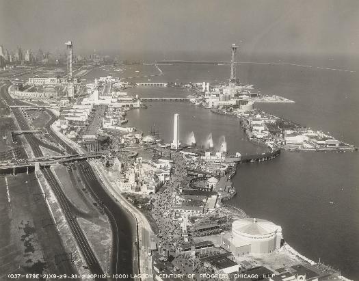
As the Burnham Plan suggested, in the 1920s the city began to fill in land to develop Northerly Island. It was the first in an intended chain of connected islands to extend south to 51st Street. The goal was to create an area on the lakefront that could be used for water sports. In 1933 Northerly Island housed the botanical exhibit at the Century of Progress World's Fair. None of the other islands were ever developed.
See also: Burnham Plan; Century of Progress Exposition; Waterfront
"For the United Nations Headquarters"
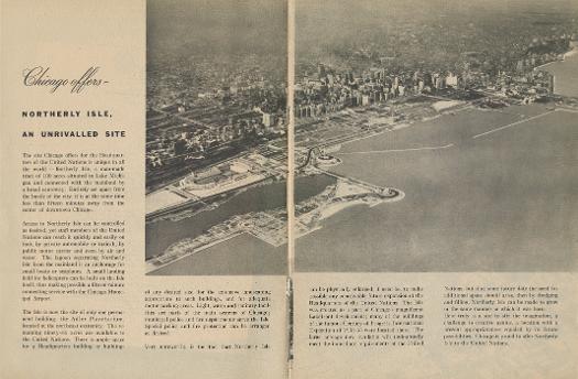
In 1945 the city of Chicago offered Northerly Island as the site for the headquarters of the United Nations. This unsuccessful proposal was in direct opposition to the island's original intended recreational use.
See also: Burnham Plan; Waterfront; World War II
Meigs Field photo, 1972
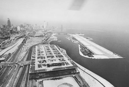
In 1948 the city opened a commuter airport, later called Meigs Field, on Northerly Island, completely abandoning its original intended use. The island operated as an airport through the end of the twentieth century.
See also: Airports, Commuter; Lake Michigan; Transportation
The Encyclopedia of Chicago © 2004 The Newberry Library. All Rights Reserved. Portions are copyrighted by other institutions and individuals. Additional information on copyright and permissions.