Index
Full Index
Authored Entries
Historical Sources
Maps
Full Map Listing
Rich Maps
Maps Created by
Encyclopedia of Chicago
Staff
Historical Maps (Alphabetical)
Historical Maps (Chronological)
Special Features
Map
Maps
Historic Maps (Alphabetical)
A
Advertisement for D. S. Taylor Property, South Chicago, c. 1873
Areas with Increased Poverty Rate, 1970-1980
Arend Van Vlissingen Plan for Lake Calumet Harbor, 1920
Armour and Morris Foreign Houses and Agencies, 1924
B
Bird’s-Eye View of Elevated Railroads, Parks, and Boulevards, 1910
Blanchard’s Guide Map of Chicago, 1862
Blanchard’s Guide Map of Chicago, 1871
Blanchard’s Map of Chicago and Environs, 1888
Blanchard’s Map of Chicago and Suburbs, 1921
C
Cartogram of “Chicago’s Place in Industrial America,” 1952
Chicago in 1812
Chicago in 1835
Chicago Tribune
Map of Chicagoland and Century of Progress Exposition, 1934
Chicago with Additions, 1836
Chicago with the School Section and Wabansia and Kinzie’s Addition, 1834
Chicago’s Central Business District, 1862
Chicago’s Central Business District and Principal Transportation Lines, 1904
Cook and DuPage, and Parts of Kane, Kendall, and Will Counties, 1851
D
Deep Draft Harbors in the Chicago District, 1947
Detail from Map of Chicago Showing Location of All Catholic Churches, 1926
Detail from Watson’s New Township and Sectional Map of Illinois, 1871
Diagram of Proposed Subdivision in Ashburn Community Area, 1943
E
Existing and Proposed Channels and Bridges, Calumet-Sag Project, 1953
Existing and Proposed Highways in the Metropolitan Region, c.1926
F
Fort Dearborn Addition to Chicago, 1839
G
General Map of Chicago, Showing the Park System, Principal Transportation Lines, and Points of Mechanical Interest, 1904
Graceland Cemetery, 1890
H
H. R. Page & Co. Guide Map of Chicago, 1879
“Hibbardville” in
A Great-Grandmother Remembers
(1940) by Addie Hibbard Gregory
Highway Map of Cook County, 1970
Hull House Map (Nationalities), 1895
Hull House Map (Wages), 1895
I
Illinois Central Railroad Slip on the Chicago River, 1895
Illinois-Wisconsin Boundary Line, 1846
Intercommunity Councils, 1963
L
Lake County Fire Protection Districts, 2003
Lake County Municipalities and High School Districts, 2003
Lake Forest, 1873
Layout of Fort Dearborn and Environs, 1808
M
Manufacturing Employment in Chicago, 1951
Map of Chicago’s Gangland
, 1931
Marquette’s Map, 1673
N
Northwest Territory, 1795
O
Openlands Project Map of Regional Waterways, 2004
P
Park Districts and Parks in Chicago, 1913
Plan of Chicago
Promotional Campaign (Ashland Avenue), 1916
Plan of Chicago
Promotional Campaign (Diagram of Proposed Superhighway System), 1927
Plan of Chicago
Promotional Campaign (Diversion of Freight Traffic), 1914
Plan of Chicago
Promotional Campaign (Downtown Projects), c.1920
Plan of Chicago
Promotional Campaign (Industry and Population Density Estimates in the Chicago Region), 1919
Plat Map of Cook County, 1861
Population Density by Wards, 1904
Portion of the South Side Levee District, 1910
Proposed Comprehensive Terminal at the South End of Lake Calumet, 1953
Proposed Improvements in Calumet River, 1953
Proposed Plan for Improving the Mouth of the Chicago River, 1830
Proposed Chicago River Straightening Project, 1921
Pullman Company Rail Network, 1885
R
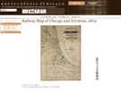
Railway Map of Chicago and Environs, 1879
Rand McNally & Co. Map of Chicago, 1886
Rand McNally & Co.’s Map of the Central Portion of Chicago, 1895
Rand McNally & Co.’s New Street Number Guide Map of Chicago, 1910
Rees & Rucker Map of Chicago and Vicinity, 1849
Revised Preliminary Plan of Grant Park, 1903
Robinson’s Atlas of the City of Chicago
, 1886
Robinson’s Map of Chicago (entire), 1886
Ross & Browne Real Estate Map of Central Chicago
S
Sewers and Sewerage District, 1857
Souvenir Map of the World’s Columbian Exposition, 1893
Stead’s Map of Nineteenth Precinct in Chicago’s First Ward, 1894
Studebaker Map of Chicago and World’s Columbian Exposition, 1893
T
Thompson’s Plat of 1830
U
Union Stock Yard, 1891
W
Water System and Pollution Drainage Maps,
Chicago Medical Record
(December 1893)
Water System and Sanitary Health Maps,
Chicago Medical Record
(December 1893)
Wright’s Survey Map of Chicago, 1834