Early Lakeshore Development: Public versus Economic Uses
From the city's inception, units of government attempted to maintain at least a portion of the lakeshore for public use. On March 2, 1827, the United States Congress granted the state of Illinois land to open a canal to connect the Illinois River with Lake Michigan. Four years later, on February 15, 1831, the state created the Board of Canal Commissioners to divide the land and sell the pieces of it to raise money for the construction of the canal. According to Fernando Jones, one of Chicago's earliest real-estate developers, one of the enticements the commissioners used to secure buyers was to dedicate a large parcel of land on the lakeshore as an open space. This area was enlarged in 1839 when the U. S. government gave the city an adjacent lakeshore portion of its Fort Dearborn military post with a specific restriction that the land be dedicated for public use. Despite these dedications private industries, most prominently the railroads and steel industries, vied for control of the lakeshore.
|
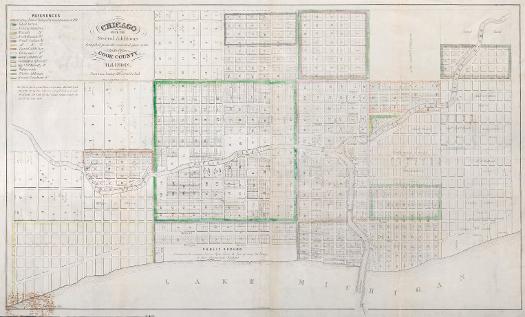
Created by the canal commissioners and recorded on July 2, 1836, this map mandates that a portion of the lakeshore be dedicated as "Public Ground. A common, to remain forever open, clear and free of any building or obstruction whatever." Named Lake Front Park, this area was bounded by Randolph Street to the north, Madison Street to the south, Michigan Avenue to the west, and the lake to the east.
See also: Illinois and Michigan Canal; Lake Michigan; Waterfront; Zoning
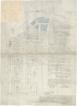
Fort Dearborn Addition Map, 1838
|
The Secretary of War dedicated a section of land, from Fort Dearborn east of Michigan Avenue to the lake and south to Twelfth Street, to the city as "public grounds forever to remain free of buildings."
See also: Chicago River; Fort Dearborn; Lake Michigan; Waterfront
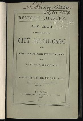
1863 Amendment to the Chicago Incorporation Act
|
|
|
The entire dedication of this land was accepted by the city through a resolution on April 29, 1844. The Illinois legislature recognized the dedication of the land and prohibition against construction upon it in several statutes and amendments including the 1861 and 1863 revised charter acts for the city of Chicago.
See also: Charters, Municipal; Government, City of Chicago; Lake Michigan; Waterfront
Illinois Central Railroad Tracks north from Harrison Street toward Van Buren Street Station and Viaduct, 1896
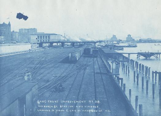
In 1852, the city encroached on the dedicated public land by granting the Illinois Central Railroad Company (ICRC) a right of way to lay tracks over the submerged land east of the shoreline and to construct a breakwater to protect its property. The city subsequently filled in the space between the shoreline and under the tracks transforming it into solid ground. When the ICRC attempted to claim that it owned this land, the Illinois Supreme Court ruled that though the railroad maintained a perpetual right of way over the ground for its tracks, the city had the right to control the submerged land east of the shoreline and the power to construct thereon public landing places, wharves, docks, and levees.
See also: Illinois Central Railroad; Illinois Central Railroad (Corporate History); Lake Michigan; Waterfront; Development of Railroad Lines from Chicago
Illinois Steel Company's South Works Plant, 1920s
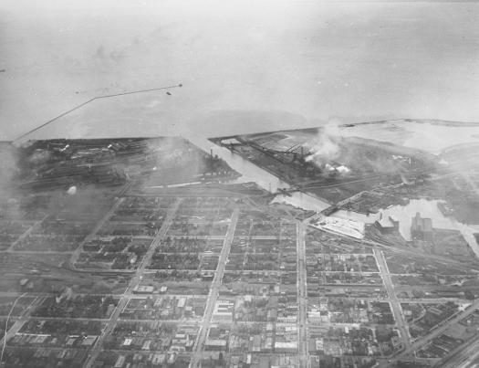
Supporting the growth and development of the railroad industry were the iron and steel mills that businessmen established on the Chicago shoreline. One of the first of these was the South Works Steel Mill, built in 1880, located at the junction of the Calumet River and Lake Michigan on the South Side of Chicago.
See also: Calumet Region; Iron and Steel; U. S. Steel Corp.; The Chicago Area's Iron and Steel Industry
The Encyclopedia of Chicago © 2004 The Newberry Library. All Rights Reserved. Portions are copyrighted by other institutions and individuals. Additional information on copyright and permissions.