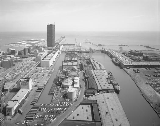
Chicago River as Harbor
The Chicago River was not a naturally ideal harbor. A sandbar blocked the entrance for all but the smallest crafts. In 1817, Samuel A. Storrow described the Chicago River as having "no advantage of harbor, the river itself being choked, and frequently barred." Over the course of nearly two centuries, the Chicago River has been reversed and shaped into a waterway very different from the one encountered by Storrow and others. By 2004, little remained of the Chicago Rivers commercial dominance. The river had become instead a center for leisure and residential development.
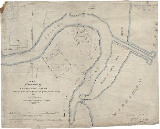
By the 1820s, soldiers at Fort Dearborn had cut a narrow passageway through this sandbar to enable their small boats to move through to the lake. With the coming of the Illinois and Michigan Canal, the Corps of Engineers formulated plans for improving the river. William Howard mapped the plan seen here in 1830, including the closure of the original river outlet, the excavation of a new district channel into the lake, and the construction of two piers alongside this channel. In 1833, Congress approved $25,000 for improvements, which were completed by 1835.
See also: Illinois and Michigan Canal; Water; Loop
Over the course of several decades, the Chicago River was widened and dredged. Initially, private individuals and companies improved docks and wharves along the river. But with time, the abutting owners increased water frontage by digging slips alongside the river. William B. Ogden, the first mayor and early booster of Chicago, oversaw the investments of the Chicago Dock Canal and Company including considerable property on Chicagos Near North Side. The company built a slip parallel to the north bank of the Chicago River, which was used as harbor and warehouse space into the twentieth century. The North Pier Terminal Building at 435 East Illinois was built between 1905 and 1920 and was renovated to retail and commercial space in 1990.
See also: Real Estate; Near North Side
Illinois Central Railroad Slip, 1895
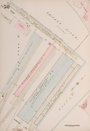
The connection between railroads and the Chicago harbor was a close one. The Galena and Chicago Union Railroad, the first into the city, laid tracks to the west bank of the North Branch of the Chicago River in 1848. A few years later, the Illinois Central Railroad laid tracks right up to the south bank of the main stem of the Chicago River along Lake Michigan. This 1895 map of the railroad holdings, depicts the use of the property as a transshipment point.
See also: Illinois Central Railroad; Loop; Waterfront
Harbor Scene on the Chicago River, 1893
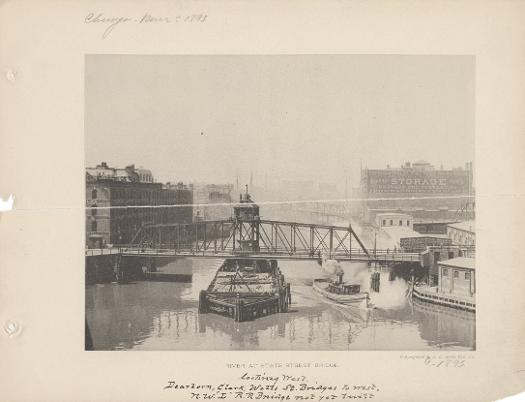
At the time of the Worlds Columbian Exposition, activity in the Chicago River Harbor was near its peak. Seen here is the river at the State Street Bridge, looking west. Note the warehouses and docks lining the banks of the river, and the tugboat near the Dearborn Street Bridge.
See also: Chicago River; Water
The Encyclopedia of Chicago © 2004 The Newberry Library. All Rights Reserved. Portions are copyrighted by other institutions and individuals. Additional information on copyright and permissions.